


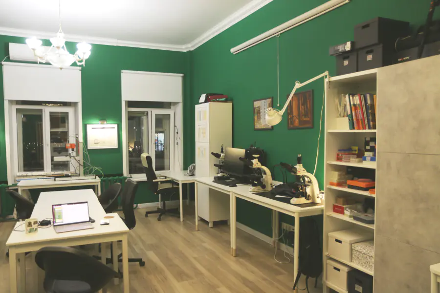
Лаборатория палеоархивов природной среды образована в 2019 году в рамках программы по созданию молодежных лабораторий Минобрнауки России.
Область исследований: диагностика природно-климатических событий плейстоцена и голоцена на территории России путем детального анализа осадочных летописей различного типа (озерно-болотные, лёссово-палеопочвенные, аллювиальные, склоновые).
Основные исследовательские задачи:
1. Совершенствование методов исследования седиментационных палеоархивов.
2. Детализация палеореконструкций, переход от осредненных сглаженных построений к событийному уровню.
3. Выявление хроностратиграфических маркеров резких изменений природной среды.
4. Диагностика следов вулканических палеособытий.
5. Выявление и оценка повторяемости гидрометеорологических экстремалий.
6. Реконструкция природных условий прошлого в контексте археологических исследований.
- Бурение донных отложений
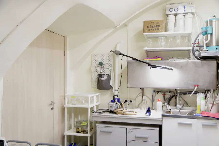
- Геостатистика
- Гиперспектральное сканирование кернов донных отложений
- Глубинно-возрастные модели
- Гранулометрия
- Диатомовый анализ (Diatom analysis)
- Криптотефра
- Петромагнетизм
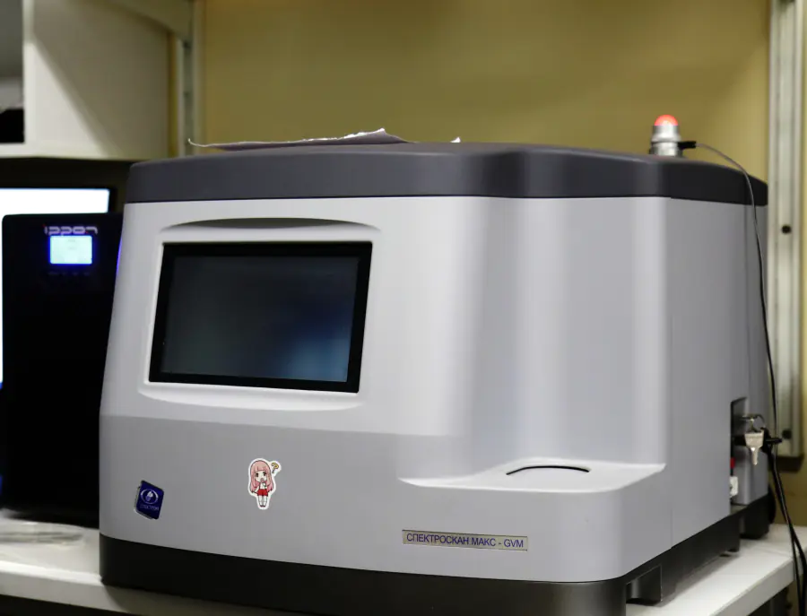
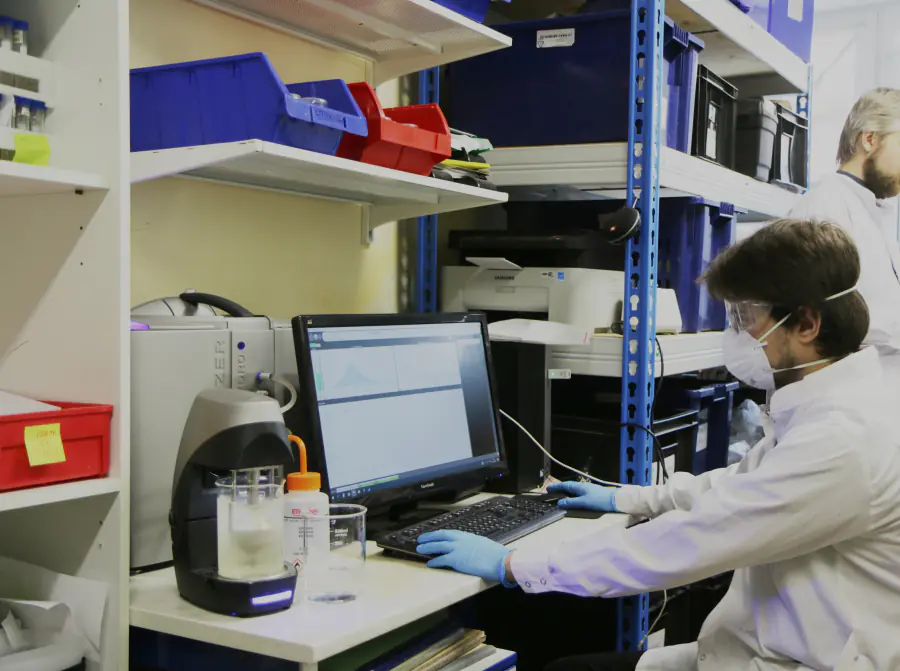
- Рентгенофлуоресцентный анализ (X-ray fluorescence)
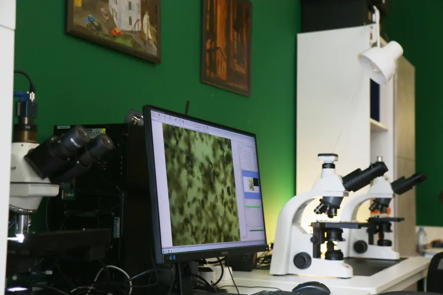
- Световая микроскопия
- Спорово-пыльцевой анализ
- Георадиолокация
- Геохронология
- Сравнительно-географический
- Варвометрия
- Лёссово-почвенная стратиграфия
- Хирономидный анализ

Топ-100
Области наук
|
1
2
|
|
|
Earth-Surface Processes
|
Earth-Surface Processes, 2, 33.33%
Earth-Surface Processes
2 публикации, 33.33%
|
|
Ecology, Evolution, Behavior and Systematics
|
Ecology, Evolution, Behavior and Systematics, 1, 16.67%
Ecology, Evolution, Behavior and Systematics
1 публикация, 16.67%
|
|
Oceanography
|
Oceanography, 1, 16.67%
Oceanography
1 публикация, 16.67%
|
|
Paleontology
|
Paleontology, 1, 16.67%
Paleontology
1 публикация, 16.67%
|
|
Earth and Planetary Sciences (miscellaneous)
|
Earth and Planetary Sciences (miscellaneous), 1, 16.67%
Earth and Planetary Sciences (miscellaneous)
1 публикация, 16.67%
|
|
Geology
|
Geology, 1, 16.67%
Geology
1 публикация, 16.67%
|
|
Global and Planetary Change
|
Global and Planetary Change, 1, 16.67%
Global and Planetary Change
1 публикация, 16.67%
|
|
Arts and Humanities (miscellaneous)
|
Arts and Humanities (miscellaneous), 1, 16.67%
Arts and Humanities (miscellaneous)
1 публикация, 16.67%
|
|
Archeology
|
Archeology, 1, 16.67%
Archeology
1 публикация, 16.67%
|
|
1
2
|
Журналы
|
1
2
|
|
|
Quaternary International
2 публикации, 33.33%
|
|
|
Journal of Quaternary Science
1 публикация, 16.67%
|
|
|
Quaternary Science Reviews
1 публикация, 16.67%
|
|
|
Oceanology
1 публикация, 16.67%
|
|
|
Водные ресурсы
1 публикация, 16.67%
|
|
|
1
2
|


Цитирующие журналы
|
1
2
3
4
5
6
7
8
9
|
|
|
Quaternary Science Reviews
9 цитирований, 23.68%
|
|
|
Quaternary International
3 цитирования, 7.89%
|
|
|
Doklady Earth Sciences
3 цитирования, 7.89%
|
|
|
Holocene
2 цитирования, 5.26%
|
|
|
Журнал не определён
|
Журнал не определён, 1, 2.63%
Журнал не определён
1 цитирование, 2.63%
|
|
Herald of the Russian Academy of Sciences
1 цитирование, 2.63%
|
|
|
International Journal of Earth Sciences
1 цитирование, 2.63%
|
|
|
Geoderma
1 цитирование, 2.63%
|
|
|
Led i Sneg
1 цитирование, 2.63%
|
|
|
Dendrochronologia
1 цитирование, 2.63%
|
|
|
Eurasian Soil Science
1 цитирование, 2.63%
|
|
|
Moscow University Geology Bulletin
1 цитирование, 2.63%
|
|
|
Aeolian Research
1 цитирование, 2.63%
|
|
|
Earth Surface Processes and Landforms
1 цитирование, 2.63%
|
|
|
SPE Journal
1 цитирование, 2.63%
|
|
|
Sustainability
1 цитирование, 2.63%
|
|
|
Earth Systems and Environment
1 цитирование, 2.63%
|
|
|
Frontiers in Earth Science
1 цитирование, 2.63%
|
|
|
Journal of Archaeological Science: Reports
1 цитирование, 2.63%
|
|
|
Lithology and Mineral Resources
1 цитирование, 2.63%
|
|
|
Journal of Analytical Atomic Spectrometry
1 цитирование, 2.63%
|
|
|
Izvestiya Rossiiskoi Akademii Nauk. Seriya Geograficheskaya
1 цитирование, 2.63%
|
|
|
Vestnik of Geosciences
1 цитирование, 2.63%
|
|
|
Quaternary
1 цитирование, 2.63%
|
|
|
Геоморфология и палеогеография
1 цитирование, 2.63%
|
|
|
1
2
3
4
5
6
7
8
9
|


Цитируемые журналы


Издатели
|
1
2
3
|
|
|
Elsevier
3 публикации, 50%
|
|
|
Wiley
1 публикация, 16.67%
|
|
|
Pleiades Publishing
1 публикация, 16.67%
|
|
|
The Russian Academy of Sciences
1 публикация, 16.67%
|
|
|
1
2
3
|
Организации из публикаций
|
1
2
3
4
5
|
|
|
Институт географии РАН
5 публикаций, 83.33%
|
|
|
Московский государственный университет имени М.В. Ломоносова
3 публикации, 50%
|
|
|
Геологический институт РАН
2 публикации, 33.33%
|
|
|
Организация не определена
|
Организация не определена, 1, 16.67%
Организация не определена
1 публикация, 16.67%
|
|
Институт экологии растений и животных УрО РАН
1 публикация, 16.67%
|
|
|
Институт геологии и минералогии имени В.С. Соболева СО РАН
1 публикация, 16.67%
|
|
|
Институт вулканологии и сейсмологии ДВО РАН
1 публикация, 16.67%
|
|
|
Гейдельбергский университет имени Рупрехта и Карла
1 публикация, 16.67%
|
|
|
Швейцарская высшая техническая школа Цюриха
1 публикация, 16.67%
|
|
|
Университет Орхуса
1 публикация, 16.67%
|
|
|
Университет Кертин
1 публикация, 16.67%
|
|
|
Центр океанических исследований имени Гельмгольца
1 публикация, 16.67%
|
|
|
Бременский университет Якобса
1 публикация, 16.67%
|
|
|
Кильский университет имени Кристиана Альбрехта
1 публикация, 16.67%
|
|
|
Зальцбургский университет
1 публикация, 16.67%
|
|
|
1
2
3
4
5
|


Страны из публикаций
|
1
2
3
4
5
|
|
|
Россия
|
Россия, 5, 83.33%
Россия
5 публикаций, 83.33%
|
|
Страна не определена
|
Страна не определена, 1, 16.67%
Страна не определена
1 публикация, 16.67%
|
|
Германия
|
Германия, 1, 16.67%
Германия
1 публикация, 16.67%
|
|
Австралия
|
Австралия, 1, 16.67%
Австралия
1 публикация, 16.67%
|
|
Австрия
|
Австрия, 1, 16.67%
Австрия
1 публикация, 16.67%
|
|
Дания
|
Дания, 1, 16.67%
Дания
1 публикация, 16.67%
|
|
Латвия
|
Латвия, 1, 16.67%
Латвия
1 публикация, 16.67%
|
|
Швейцария
|
Швейцария, 1, 16.67%
Швейцария
1 публикация, 16.67%
|
|
1
2
3
4
5
|
Цитирующие организации


Цитирующие страны
|
5
10
15
20
25
30
|
|
|
Россия
|
Россия, 27, 71.05%
Россия
27 цитирований, 71.05%
|
|
Страна не определена
|
Страна не определена, 7, 18.42%
Страна не определена
7 цитирований, 18.42%
|
|
Китай
|
Китай, 5, 13.16%
Китай
5 цитирований, 13.16%
|
|
Германия
|
Германия, 3, 7.89%
Германия
3 цитирования, 7.89%
|
|
США
|
США, 3, 7.89%
США
3 цитирования, 7.89%
|
|
Франция
|
Франция, 2, 5.26%
Франция
2 цитирования, 5.26%
|
|
Украина
|
Украина, 2, 5.26%
Украина
2 цитирования, 5.26%
|
|
Латвия
|
Латвия, 2, 5.26%
Латвия
2 цитирования, 5.26%
|
|
Швейцария
|
Швейцария, 2, 5.26%
Швейцария
2 цитирования, 5.26%
|
|
Австралия
|
Австралия, 1, 2.63%
Австралия
1 цитирование, 2.63%
|
|
Австрия
|
Австрия, 1, 2.63%
Австрия
1 цитирование, 2.63%
|
|
Армения
|
Армения, 1, 2.63%
Армения
1 цитирование, 2.63%
|
|
Бельгия
|
Бельгия, 1, 2.63%
Бельгия
1 цитирование, 2.63%
|
|
Болгария
|
Болгария, 1, 2.63%
Болгария
1 цитирование, 2.63%
|
|
Великобритания
|
Великобритания, 1, 2.63%
Великобритания
1 цитирование, 2.63%
|
|
Венгрия
|
Венгрия, 1, 2.63%
Венгрия
1 цитирование, 2.63%
|
|
Грузия
|
Грузия, 1, 2.63%
Грузия
1 цитирование, 2.63%
|
|
Иран
|
Иран, 1, 2.63%
Иран
1 цитирование, 2.63%
|
|
Ирландия
|
Ирландия, 1, 2.63%
Ирландия
1 цитирование, 2.63%
|
|
Испания
|
Испания, 1, 2.63%
Испания
1 цитирование, 2.63%
|
|
Канада
|
Канада, 1, 2.63%
Канада
1 цитирование, 2.63%
|
|
Таджикистан
|
Таджикистан, 1, 2.63%
Таджикистан
1 цитирование, 2.63%
|
|
Турция
|
Турция, 1, 2.63%
Турция
1 цитирование, 2.63%
|
|
Швеция
|
Швеция, 1, 2.63%
Швеция
1 цитирование, 2.63%
|
|
ЮАР
|
ЮАР, 1, 2.63%
ЮАР
1 цитирование, 2.63%
|
|
5
10
15
20
25
30
|
- Мы не учитываем публикации, у которых нет DOI.
- Статистика пересчитывается раз в сутки.
Направления исследований
Реконструкция природных событий по высокоразрешающим седиментационным палеоархивам центра Восточно-Европейской равнины за последние 25 тысяч лет
Поступление пыли на равнины Предкавказья за последние 250 тысяч лет: источники, темпы, факторы
РЕКОНСТРУКЦИЯ ПРИРОДНЫХ СОБЫТИЙ ПРОШЛОГО НА ТЕРРИТОРИИ РОССИИ ПО ДАННЫМ ИЗУЧЕНИЯ СЕДИМЕНТАЦИОННЫХ ПАЛЕОАРХИВОВ
Публикации и патенты

Партнёры


